Category Archives: Beach Rides

Muskegon State Park – Fat Bike Beach Ride

13 miles – Sandy Beach – Muskegon State Park

Highlights: 2.5 miles of undeveloped Lake Michigan Beach.

Trailhead: This ride starts in the day-use beach area at Muskegon State Park. It is located on the south end of the park near the channel to Muskegon Lake.  There are 2 paved parking areas that each hold at least 200 vehicles.  Between the 2 lots you will find a beach house with restrooms and changing areas.

A Michigan Recreation Passport or $9 day pass is required for non-resident vehicles.

Driving Directions >>

The Ride:  At the start the beach is about 400 feet wide and you may have to push your fat bike down to the water depending on the time of the year. This ride goes out and back to the north. For about the first mile you will see the Scenic Drive running parallel to the shoreline just above you. There are a couple different spots where the road shoulder is wide enough to park cars and you will notice more people on the beach in these areas.  When the road swings inland you should start seeing less traffic.  This is also the beginning of the less developed and most scenic part of the ride.

At about 2 miles you come to the Lake Michigan Campground beach area. Muskegon State Park has 244 modern campsites split between here and the Channel Campground on Muskegon Lake. On a nice summer day you will encounter a big groups of campers spread out enjoying the beach here.

About a 0.3 miles past the campground you pass the northern border of the State Park and homes and cottages begin.  You will also start to see more wood break walls that were installed by property owners to control beach erosion.  Most were easy to navigate around or you can try and bunny hop the shorter ones.

At about 4 miles into the ride you will pass Pioneer County Park.  This 145 acre park is operated by Muskegon County and has just under a 0.5 mile of beach frontage.  According to their website they also offer: “modern camping, swimming, sunbathing, picnicking, tennis, softball, basketball and volleyball.”  This would probably be the best place of a pit stop along this ride if you need one.

After Pioneer Park the next 2.5 miles are smooth pedaling with few obstacles.  At 6.5 miles in there is a maze of break walls running both along shore and out into to the water.  I shouldered the bike and started walking around the first couple, but then it became apparent that to continue I would have to either walk in the water or trespass to get around.  The water was still in the 40s so I decided to make this the turnaround point.  Passage here will likely vary from year to year based on Lake levels and sand bars.

I had planned to continue on another 4 miles up to the White Lake Channel and see the White River Light Station.  If you do this ride please let us know in the comments below if you were able to make through this section.  

 Map:

Post Ride Beverage: There are only a couple options right by Muskegon State Park.  The Red Rooster Tavern is only 6 miles north on Scenic Drive so we thought we would give it a try.  It is a typical tavern atmosphere with okay pub food.  There was an interesting mix of people with everyone from families to bikers.  Most of the bikers were the kind that wear the leather chaps…if you are running these on your fat bike you are a true BA.

I did see that the Red Rooster has new owners since our last visit.  It sounds like they have updated both the interior and the menu.  We will have to check it out the next time we are in North Muskegon.  

The Bear Lake Tavern is the other option and is only 3 miles from the State Park. It looked nice when we drove past, but it has mixed reviews.

In the Area:  Muskegon State Park has 11 miles of hiking trails that are worth taking the time to explore.   We recommend the Dune Ridge Trail for a panoramic view of the harbor and the dunes leading out to Lake Michigan.  Muskegon State Park hiking guide and map >>

18-muskegon-state-park-pano

The view from the Dune Ridge Trail. (Click the image to see the full screen version)

Links:

Ride Photos:

muskegon-parking-area

The parking area and beach house at Muskegon State Park.

muskegon-beach-ride

Beach erosion breakwall.

breakwalls-north-muskegon

The barricades at the turn around point of the ride.

end-beach-ride-muskegon

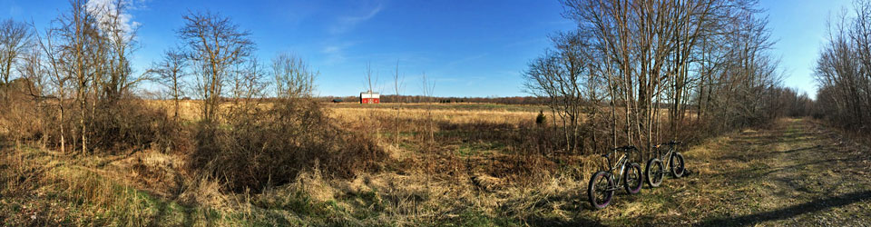
Back to the Muskegon State Park Beach at the end of the Fat Bike ride.

A GoPro time-lapse video of the beach ride.

Make sure to come back and Rate This Ride at the top of this page.


Facebooktwittergoogle_plusredditpinterestlinkedinmailby feather

Warren Dunes State Park – Fat Bike Beach Ride

5.0
01

10 miles – Sand Beach – Warren Dunes State Park, MI

*Unfortunately the Michigan DNR is no longer allowing fat bikes on the beach in Warren Dunes State Park.  See the comment section below for the latest updates on this.

Highlights: 3 miles of undeveloped Lake Michigan beach – Dunes up to 260 feet tall – An armed security force.

Trailhead: This ride starts in the day-use beach area at Warren Dunes State Park.  This is one of the most popular Michigan State Parks with over 1 million visitors each summer.  To handle all this traffic there are 5 big paved parking areas and 3 restroom buildings.  In the middle building you will find a concession with food and souvenirs in season.

A Michigan Recreation Passport or $9 day pass is required for non-resident vehicles.  Directions >>

The Ride: Saddle up on your fat bike and try to blast through the soft sand out to the waterline.  I have heard that on a clear day you can see the Chicago skyline floating on horizon straight to the west.  Take a quick look and then hang a right and head up the beach.

The first 3 miles of this ride are in the State Park.  Looking inland you will see several dunes that tower 200 feet or more above the Lake.  When I was here the conditions were almost perfect with flat hard packed sand and calm wind.

Right after leaving the State Park you will come to a big painted concrete structure that I think is the base of an old water tower.  This marks Weko Beach Park . This 40 acre park is operated by the city of Bridgman and looks like it would be a nice place to spend a day on the shores of Lake Michigan. It has a new beach house with restrooms and a food concession stand. There is also a 70 site modern campground here.

The next 2 miles are along a more developed section of beach.  I was stopped several times by mostly nice cottage and homeowners to ask me more about the fat bike.  It may be a good idea to do this ride earlier in the morning if you are here in July or August.

At about the 5 mile mark you come to a barricade of big steel poles that run out into the water about 150 feet.  There is also a “Private Property” sign that lets you know that “THIS AREA IS PATROLLED BY AN ARMED SECURITY FORCE.”  This is the start of the Cook Nuclear Energy Plant property.  I think you could probably sneak your handle bars in between the poles, but I decided it would probably be best to turn around here.

If you are looking to put a few more miles on the fat tires, It looks like there is about another 10 miles of good beach riding to the south of Warren Dunes.  I have not done this section yet.  I decided to go to the north because it looks like it is all homes and cottages along this section.  On the maps it looks like you should be able to make all the way to the channel in New Buffalo, MI.

Map:

Post Ride Beverage: After the ride It would be nice to kick back on the beach with a cooler, but unfortunately there are alcohol restrictions at Warren Dunes from March 1 to September 30.  We were planning to visit Greenbush Brewing Company when we were here, but it didn’t work out.  If you live in the area and have a recommendation please let us know in the comments below.

In the Area: The T.K. Lawless Mountain Bike Trail is just over an hour away from Warren Dunes in Vandalia, MI.  It is a long drive, but this 10 miles of hard packed rolling and twisting single track that is worth the trip.  See more at: http://www.mymichigantrips.com/warren-dunes-state-park-2013.html#TKLawlessPark

Links:

Ride Photos:

warren-dunes-beach-store

The concession at Warren Dunes State Park

beach-ride-warren-dune-stat

Perfect sand for Fat Biking at Warren Dunes State Park

drift-wood-on-beach

Nearing the north end of Warren Dunes State Park

approaching-weko-beach

Approaching Weko Beach Park

fat-bike-weko-beach

The old Water Tower Base at Weko Beach? If someone knows what this is please let us know in the comments below. Thanks.

beach-ride-end

The turnaround point at the nuclear power plant.


Make sure to come back and Rate This Ride at the top of this page.


Facebooktwittergoogle_plusredditpinterestlinkedinmailby feather

Grand Sable Dunes – Fat Biking

5.0
01

12 miles – Sand and Rocky Beach – Pictured Rocks National Lakeshore, Michigan.

Highlights:  300 foot tall sand dunes, Sable Falls, Lake Superior shoreline.

Trailhead:  I started from Woodland Park Campground which is where we were stayed while we were in Grand Marais.  There is also a good beach access right at the end of M-77 in town.  Directions >>

The Ride: This out and back beach ride starts in the sweet little town of Grand Marais in Michigan’s Upper Peninsula.  It follows west along the shore of Lake Superior and below the Grand Sable Sand Dunes that are part of Pictured Rocks National Lakeshore.

To start hop on your fat bike and head west along the sandy beach with low dune bluffs.  As you approach the mouth of Sable Creek at about 1.5 miles the shore starts to change to a mix of rocks and sand.  Before crossing the creek you will see a hiking trail that leads up to Sable Falls in about a 0.25 mile.  The water cascades off from several different cliffs that total about 75 feet tall.  Right after the creek the main dunes begin and this was also some of more difficult riding of the day.  You will have to navigate your fat tires over piles of small loose rocks and also a few spots with rock up to the size of baseballs.  The waves and ice are continully changing the shoreline so the conditions will very from year to year.  After the short rocky section it was smooth riding the rest of the way right along the base of the impressive dunes.  At about 6.5 miles a was forced to turn around by a sand slide that took some trees right down into the water with it.

This ride gives you an up close view of the Grand Sable dunes that few get to see and is one of my favorite beach rides I have done on my fat bike.

Map:

Post Ride Beverage: Lake Superior Brewing Company is one of our favorite “up north” restaurants and we always make at least one stop here when we are in the area.  The food is good, the beer is good and the atmosphere is perfect for relaxing after a day exploring Pictured Rocks.  If it is a busy weekend they may be out of some of the beer and a couple things on the menu, but I think this is just part of the charm of a small town brewery.

In the Area: Check out the Log Slide Overlook for an awesome view of the Grand Sable Dunes and the shore that you just rode.

Links:

Ride Photos:

A GoPro time-lapse video of the ride.

Near the mouth of Sable Creek.

Near the mouth of Sable Creek.

Sable Falls

Sable Falls

A spring flowing from the base of the dunes into Lake Superior

grand-sable-dunes-fat-bike

Taking a break near the turn around point of the ride.

Make sure to come back and Rate This Ride at the top of this page.


Facebooktwittergoogle_plusredditpinterestlinkedinmailby feather