6.4 miles – Winter Single Track – Rockford, Michigan
Highlights: Groomed snow at the top trail in West Michigan.
Trailhead: The start of the Merrell Trail is somewhat hidden off 10 mile road just east of US 131 in Rockford, MI. After exiting the highway head east and make a quick right hand turn at the first stop light. The pavement ends in about 300 feet and it turns to a narrow gravel road that leads to the trailhead. The parking is just past the big water tower, you can look for this if you are not sure where to go. In the summer there is portable toilet, but in the winter all you will find is a plowed parking lot and information board.

The start of the Merrell Trail is just up the hill from the parking area.
The Merrell Trail opened in 2012 and quickly became a favorite of local mountain bikers. The trail gets it’s name from the Merrell outdoor shoes. Merrell is a brand of the footwear giant Wolverine World Wide which is also headquartered in Rockford, MI. Wolverine provided much of the funding to have this trail professionally built and their employees also worked with the West Michigan Mountain Biking Alliance to help with the build. The result is fast and flowing single track that is fun to ride in both summer and winter.
The trail is currently being groomed for fat biking in the winter by volunteers with snowmobiles pulling drags. Make sure to check trail conditions on their Facebook page before heading out. The trail will occasionally be closed when there is a big thaw.
The Ride: The trail starts by the sign board on top of the small hill to the west of the parking area. Note that the direction the trail is ridden changes based on the day of the week. On Tues, Thurs and Sat start to the left and follow the yellow markers. Sun, Mon, Wed and Fri start to the right and follow the red markers. I should also mention that this trail was designed for bikers, but it is considered a multi-use pathway. All other users are asked to go in the opposite direction. I will be describing the yellow direction below.
The first 0.4 miles of trail heads almost straight south and serves as an access to the main loops. After this stay to the left and continue on to the 0.75 mile Chameleon Trail. You will soon start seeing the rolling terrain that this trail is known for. At the end of Chameleon there is a cut back that you could take over to Mix Master for a shorter loop of about 2.75 miles.
To stay on the main trail continue slightly left to pick up the Wilderness Trail. This trail twists around in some fairly thick pines for a little while and then opens up back in the hardwoods. This section is probably some of the finest trail you will find in West Michigan. It is fast and flowing with big berms in the corners. It is a little slower on the fat tires in the snow, but still fun to ride. At about 2 miles into the ride you get down near the bottom of the valley and the end of the Wilderness Loop.

The snow covered bridge that leads to the Sawtooth Trail in the summer.
The Wynalda Loop heads off to left here and if it looks like it has been packed, head up that way. The other option is to continue straight to post 8 and pick up Siren. The Wynalda Loop at 1.75 miles is the longest named trail at Merrell. This loop has a decent amount of climbing and is definitely harder in the snow. 2 different sections of this trail run along the edge of the treeline by the sports fields. Winds from the north or west can drift these open parts over and you may have to do some hike-a-fat-bike at times. This loop then dumps you out almost right back where you turned off. Stay to the left again and follow Siren along bottom of the valley.
Continue on Siren until you get to post 6 which is the turn off for Phaser. Along the way you will pass the snow covered bridges at the start the Sawtooth Trail. Sawtooth is too tight to be groomed and usually not passable in the winter. The turn off for Phaser is also easy to find because the rest of Siren is not groomed either. Phaser is 0.75 miles long and takes you back up and out of the valley. As you top out at the end of the trail you will see a picnic table and an information board with a trail map. This is good spot to take a well earned rest.

The Moonlander by the trail map at marker #4 on the Merrell Trail..
From here the Mix Master Trail is a fun winter ride as it twists it’s way through the west part of the property. After another rolling 1.5 miles this trail spits you back out on the straight connector heading back to the parking lot in less than a 0.5 mile . If you still want to put on some more miles, at the end of Mix Master you can take a hard right and head out for another loop by connecting back up with Chamelon.
All these trails and names may sound a little complicated, but if you look at the map below it will make more sense. The start of each trail is also marked by a metal sign with the trail names in cut out letters.
Ride Map:

Here is a photo of the map posted at the trailhead. *Click the map to see a larger version*
The winter route in Strava:
Ride Photos:
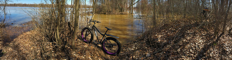
GoPro timelapse photos of the winter fat bike trail at Merrell.
Post Ride Beverage: The Rockford Brewing Company looks worth checking out, but we have not made it there yet. If you are a Rockford local please give us your recommendation in the comments below.
In the Area: Make sure to come back and ride Merrell in the dirt. Rockford is also home to another one of West Michigan’s top mountain bike trails at Luton Park. This stacked loop trail system has just over 9 miles of rolling single track. Luton Park can be found 4 miles west of Merrell, right on 10 mile road. Luton is a multi-use trail and at times some sections will get packed well enough to be ridden in the winter. See more at Friends of Luton Park on Facebook.
Links:
- The Merrell Trail Facebook Page – check for trail condition updates.
- YouTube video about making the Merrell Trail.
- The Merrell Trail on MTB Project
Make sure to come back and Rate This Ride at the top of this page.


