2.7 + miles – Winter Multi-Use Trail – Holland, Michigan
Highlights: Winter riding near the Lakeshore.
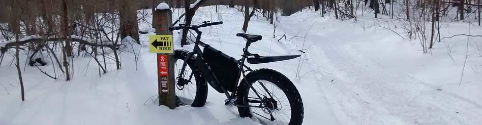
 Trailhead: Riley Trails is located on the north side of Holland on Riley St about 4.5 miles west of US 31. The entrance is on the south side of the road and is marked with stone pillars holding a wooden sign with red letters. At the trailhead there is a pit toilet and a few informational boards with maps.
Riley Trails are on 300 acres of county land that was used as a land fill up until 1979. There are now 7 miles of marked mulit-use trails at this park. This is not a destination ride, but it is becoming a popular place for locals to put a few miles on their fat bikes in the winter. Most of the time you will not even know that you are riding around an old dump. The trails were originally used for mainly cross-country skiing in the late 1980s. In 2006 management of the property was turned over to Ottawa County Parks and several improvements were made over the next couple years. The trail system was also remarked and mapped.
After this was done the number of both summer and winter trail users really increased. The trails are not groomed, but with all of the skier and snowshoe traffic they are usually packed well enough for fat bikes most of the winter. Although, after significant snow you may want to give it a few days for things to get packed down again. Also, if there is a big thaw and then a freeze the trails can get too rough to ride. The warm weather always seems to bring out the walkers and runners and when their footprints freeze things get a little bumpy until they get filled with snow again.
All of the trails are open to exploring on fat bikes, but below I will describe a loop that is most likely to rideable in the winter. If you get out here and the riding conditions are not favorable there are couple other options nearby. See the “In the Area” section below for other rides.
The Ride: in 2012 a 4.5 mile mountain bike loop was pieced together with many of the existing trails. In the winter the beginning and end of this loop can usually be ridden. The back half usually doesn’t get enough traffic to pack the snow. I will explain how to connect the beginning and end of the bike trail with the service road for a winter loop of about 2.7 miles.

This start of the mountain bike trail.
This fat bike ride starts in the southeast corner of the parking lot by a green sign that shows the map for the “Riley Trails Mt. Bike Course.” Ride past the sign and follow the brown fiberglass posts with mountain bike trial markers. This first section of trail is fairly straight and flat with just one small hill to climb over. It makes a right angle as it follows the north and then east borders of the property. You will see a few side trails heading off to the right, but you will want to stay straight following the bike markers. At about 0.7 miles you climb a small hill up to a service road.

The service road at Riley Trails
At this point the trails split off in several different directions and many of these are usually not packed well enough to ride. However, the service road is usually plowed. You will want to take a right on the road heading towards the hill from the old landfill. After about 0.1 miles you will see the mountain bike trail markers heading across the open area to the left. If the trail looks like it has had some traffic you can try to continue on the marked bike loop. Most of the time this will not be good to ride and you will want to continue on the service road and go around the gate as it curves to the left. You will be on this road for the next 0.75 miles as goes around the old landfill. After a straight section the road curves to the right and then back to the left and you will see a chain link fence that is the southern edge of the property. The road will go back to the right away from the fence, but you will want to go to the left of the snow pile and pick up the trail along the fence. The trail will climb up a hill through some pine trees and then after you go back down you will be right next to the fence again. Continue straight as the mountain bike trail joins back in from the right. From here you will be able to follow the brown mountain bike markers for the rest of the ride. After paralleling the fence for about 0.2 miles a marker points you to the right into the pines.

Nearing the left turn off on the service road.
You will be in this section of fairly thick pines for about the next 0.6 miles. This part has some small hills that keep the ride a little more interesting and is also really nice when there is new snow hanging in the trees. At about 2.2 miles into the ride you turn to the left and leave the pines and enter the hardwoods. In another 0.1 miles you climb a little rise and then you will want to stay to the right when the trail tees at the top. Next you drop down the biggest hill of ride and soon you will see the trees opening up to the pond on your left. This section is more open and tends to drift and be a little rougher than the rest of the trail. At times you may have to push your fat bike for the last couple hundred feet here. The bridge over the pond on the left takes you back to the parking area and the end of the loop at 2.7 miles.
Next you can go for another loop or check out the trail map and try to explore some of the other trails. Staying on the trails closer to the the parking is usually best.

Entering the pines section at Riley Trails.

The mountain bike trail markers.
Ride Map:
Ride Photos:
GoPro timelapse photos of the winter fat biking loop at Riley Trails.
Post Ride Beverage: Try Big Lake Brewing just 2.5 miles away at 977 Butternut Drive #4. This place is all about the beer. If you are hungry you can get takeout from one of the nearby restaurants.

Big Red at Holland State Park
In the Area: About 1.25 miles west of Riley Trails you will find a Lake Michigan beach access off the end of Riley Street. The township usually does good job of keeping the bike paths plowed, making this is an easy ride on the fat bike out to the lake. If the beach is not snowed in you can ride south for about 3.5 miles to Holland State Park. If the beach conditions are not good for riding the bike path along Lakeshore Drive is a good alternate route. Combining the beach and bike path would also be a good option for a loop.
Links:
Make sure to come back and Rate This Ride at the top of this page.